|
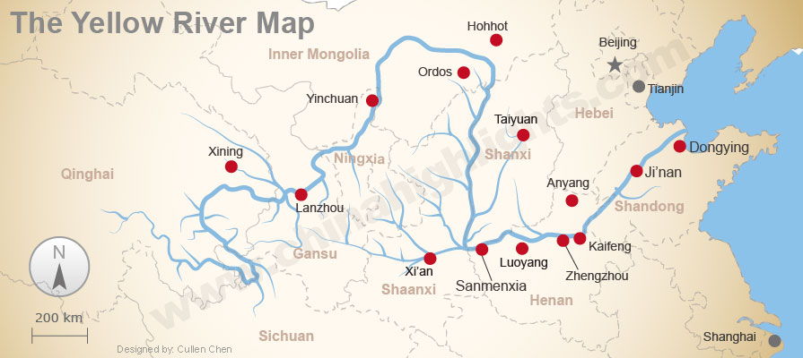
The Yellow River the third-longest river in Asia, following the Yangtze River and Yenisei River, and the sixth-longest in the world at the estimated length of 5,464 km.It empties into the Bohai Sea near the city of Dongying in Shandong province.
Its basin was the birthplace of ancient Chinese civilization, and it was the most prosperous region in early Chinese history. However, because of frequent devastating floods and course changes produced by the continual elevation of the river bed, sometimes above the level of its surrounding farm fields. Almost all the cities are located around the rivers or other water resources. It means that most of the population live along the water resources(The Yellow River watershed has been a major water resource for the Chinese civilization.) |
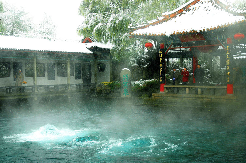
Shandong ProvinceYellow River Watershed
|

LakefieldSaint Lawrence Watershed
|
Water Risk
Overall water risk identifies areas with higher exposure to water-related risks and is an aggregated measure of all physical and chemical indicators.
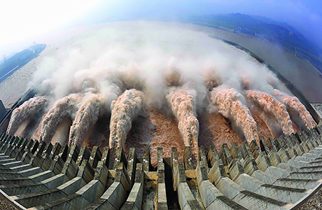
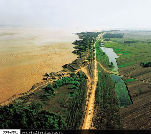
Due to sedimentation, a total length of 5464 km of the Yellow River riverbed is higher than the basin of the city, farmland, thus it is called " hanging river ."
In the 1970s , due to rapid economic development, industrial and agricultural water consumption increased and a lot of water is pumped . Runoff of the Yellow River reached 57.5 billion cubic meters by 1950, caused severe degradation of the ecosystem of the Yellow River. The Chinese government began to restrict water and trim the river since 1998, so the Yellow River has not dry up since 2000. But now the Yellow River still faces threats of drying up from time to time.
Overall water risk identifies areas with higher exposure to water-related risks and is an aggregated measure of all physical and chemical indicators.
Due to sedimentation, a total length of 5464 km of the Yellow River riverbed is higher than the basin of the city, farmland, thus it is called " hanging river ."
In the 1970s , due to rapid economic development, industrial and agricultural water consumption increased and a lot of water is pumped . Runoff of the Yellow River reached 57.5 billion cubic meters by 1950, caused severe degradation of the ecosystem of the Yellow River. The Chinese government began to restrict water and trim the river since 1998, so the Yellow River has not dry up since 2000. But now the Yellow River still faces threats of drying up from time to time.
Media Coverage of Water Risk
Media coverage measures the percentage of all media articles in an area that cover water-related issues. Higher values indicate areas with higher public awareness around water issues, and consequently higher risks to those not sustainably managing water.
Shandong: High risk(3-4) and extremely high risk(4-5)
LCS: Low to medium risk (1-2)
Factors that made the differences:
LCS is at a low to medium water risk, it is located at Saint Lawrence Watershed which is consisted of calm rivers and streams.
Shandong province is at a high water risk, part of it is under extremely high water risk. The river basins are high above the ground, some parts even reached several metres, it reached extreme physical water risk to the human population and habitats. The Yellow River brings a big amount of sands and soils down the watershed.
Agency responsible for monitoring the water use, sanitation and water pollution:
Chinese Research Academy of Environmental Sciences: Since the establishment in 1978, as a national non-profit research institute for environmental protection, Chinese Research Academy of Environmental Sciences (CRAES) has already gained notable fruits in fields of environmental capacity, prevention and control of acid rain and lake eutrophication, water pollution remediation and control, atmospheric pollution remediation and control, solid waste pollution prevention, conservation of ecosystem, cleaner production and circular economy, etc., which goes closely around demands of national economic social development as well as environmental protection progress.
Problems:
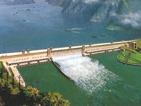
The water has very severe impacts on China. The Yellow River has been causing flood and drought in the Middle and Northern China, changing landforms and threatening many habitats. The cities near the Yellow River are all under threats of flooding, and the flood would be big if it ever happened. The dam on the Yangtze River is also causing large shifts of habitats and harms to the environment and extinction of species. The Chinese government already realized the threats and harms those water could bring to its people and its environment, and I sincerely hope that they could come up with solution that can protect all people from potential disasters.
Media coverage measures the percentage of all media articles in an area that cover water-related issues. Higher values indicate areas with higher public awareness around water issues, and consequently higher risks to those not sustainably managing water.
Shandong: High risk(3-4) and extremely high risk(4-5)
LCS: Low to medium risk (1-2)
Factors that made the differences:
LCS is at a low to medium water risk, it is located at Saint Lawrence Watershed which is consisted of calm rivers and streams.
Shandong province is at a high water risk, part of it is under extremely high water risk. The river basins are high above the ground, some parts even reached several metres, it reached extreme physical water risk to the human population and habitats. The Yellow River brings a big amount of sands and soils down the watershed.
Agency responsible for monitoring the water use, sanitation and water pollution:
Chinese Research Academy of Environmental Sciences: Since the establishment in 1978, as a national non-profit research institute for environmental protection, Chinese Research Academy of Environmental Sciences (CRAES) has already gained notable fruits in fields of environmental capacity, prevention and control of acid rain and lake eutrophication, water pollution remediation and control, atmospheric pollution remediation and control, solid waste pollution prevention, conservation of ecosystem, cleaner production and circular economy, etc., which goes closely around demands of national economic social development as well as environmental protection progress.
Problems:
The water has very severe impacts on China. The Yellow River has been causing flood and drought in the Middle and Northern China, changing landforms and threatening many habitats. The cities near the Yellow River are all under threats of flooding, and the flood would be big if it ever happened. The dam on the Yangtze River is also causing large shifts of habitats and harms to the environment and extinction of species. The Chinese government already realized the threats and harms those water could bring to its people and its environment, and I sincerely hope that they could come up with solution that can protect all people from potential disasters.
Reference Links
https://en.wikipedia.org/wiki/Yellow_River
http://www.wri.org/applications/maps/aqueduct-atlas/#x=8&y=0.63&s=ws!20!28!c&t=waterrisk&w=def&g=0&i=BWS-16!WSV-16!SV-2!HFO-4!DRO-4!STOR-8!GW-8!WRI-4!ECOS-2!MC-4!WCG-8!ECOV-2&tr=ind-1!prj-1&l=3&b=terrain&m=group
http://multimedia.wri.org/watersheds_2003/
https://en.wikipedia.org/wiki/Yellow_River
http://www.wri.org/applications/maps/aqueduct-atlas/#x=8&y=0.63&s=ws!20!28!c&t=waterrisk&w=def&g=0&i=BWS-16!WSV-16!SV-2!HFO-4!DRO-4!STOR-8!GW-8!WRI-4!ECOS-2!MC-4!WCG-8!ECOV-2&tr=ind-1!prj-1&l=3&b=terrain&m=group
http://multimedia.wri.org/watersheds_2003/